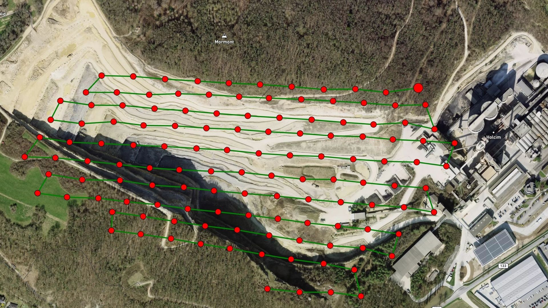
Drones are transforming spatial science by putting the ability to capture high-quality geotagged images directly into the field. This shift makes photogrammetry, terrain modeling, change detection, and feature extraction faster, more accessible, and more impactful for managing natural and built environments.
WHY USE
DRONE FOR
MAPPING &
SURVEYING
Drones are more than just a complement to ground-based tools with faster data capture, broader coverage, and new service opportunities. Whether you’re surveying land, infrastructure, or natural terrain, drone mapping helps you deliver results with accuracy, speed, and confidence.
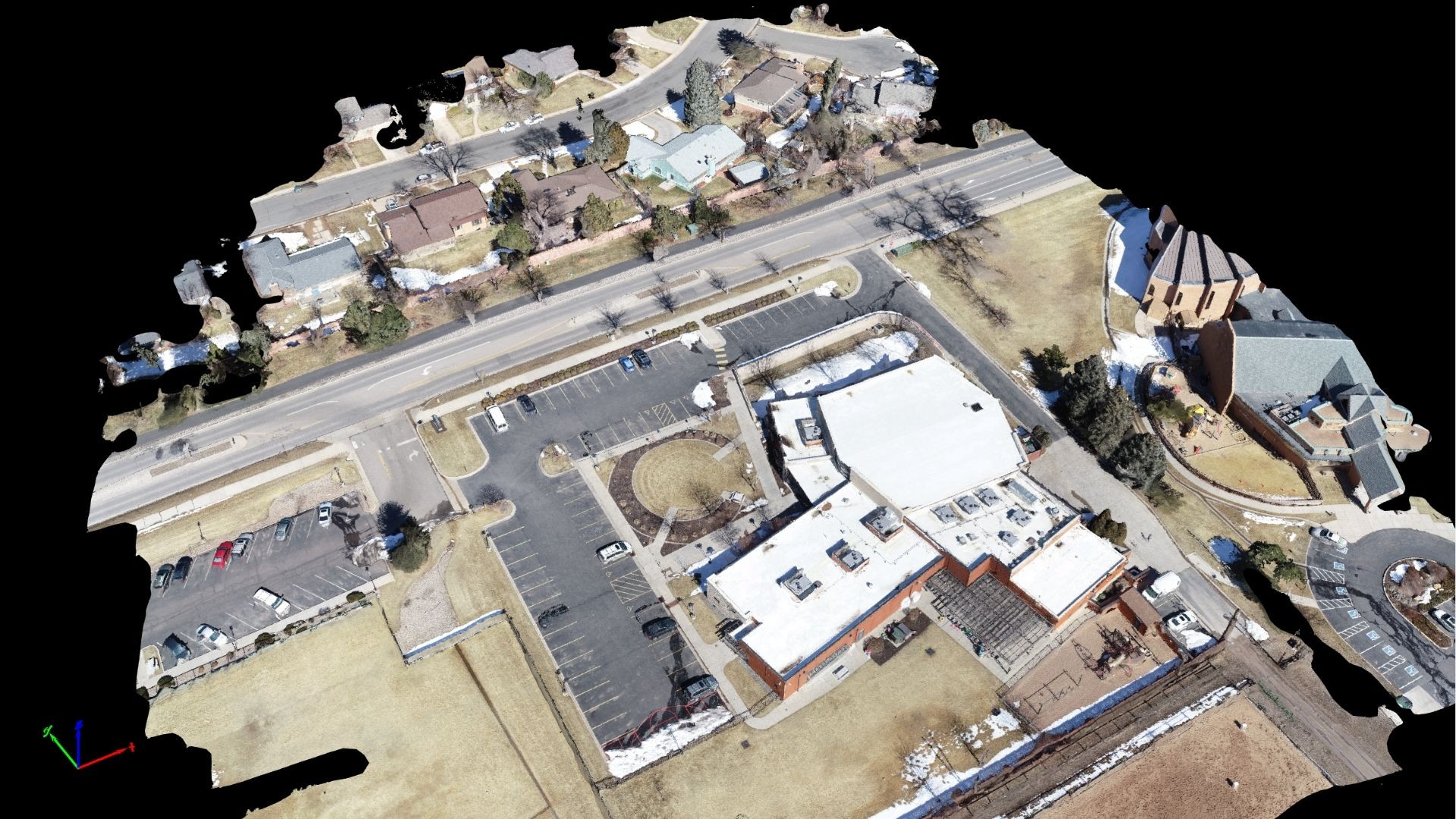
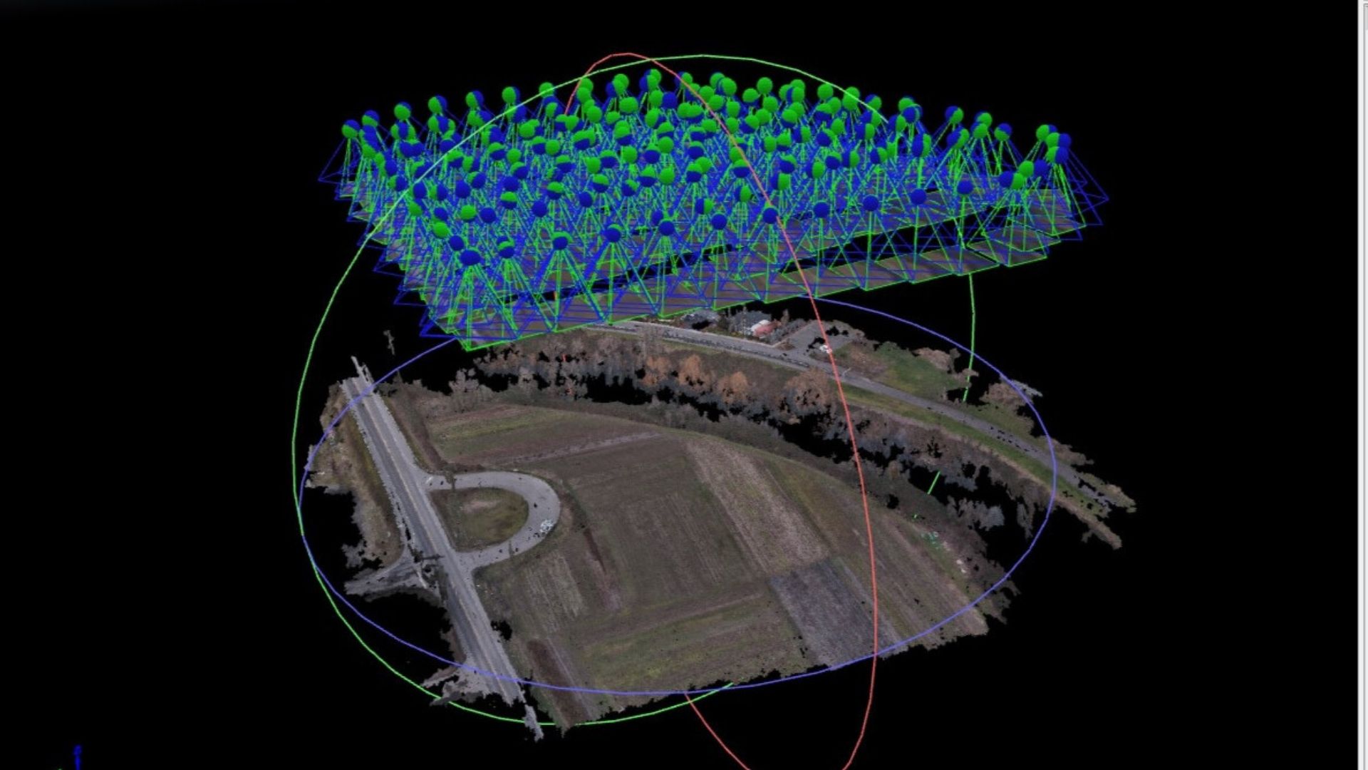
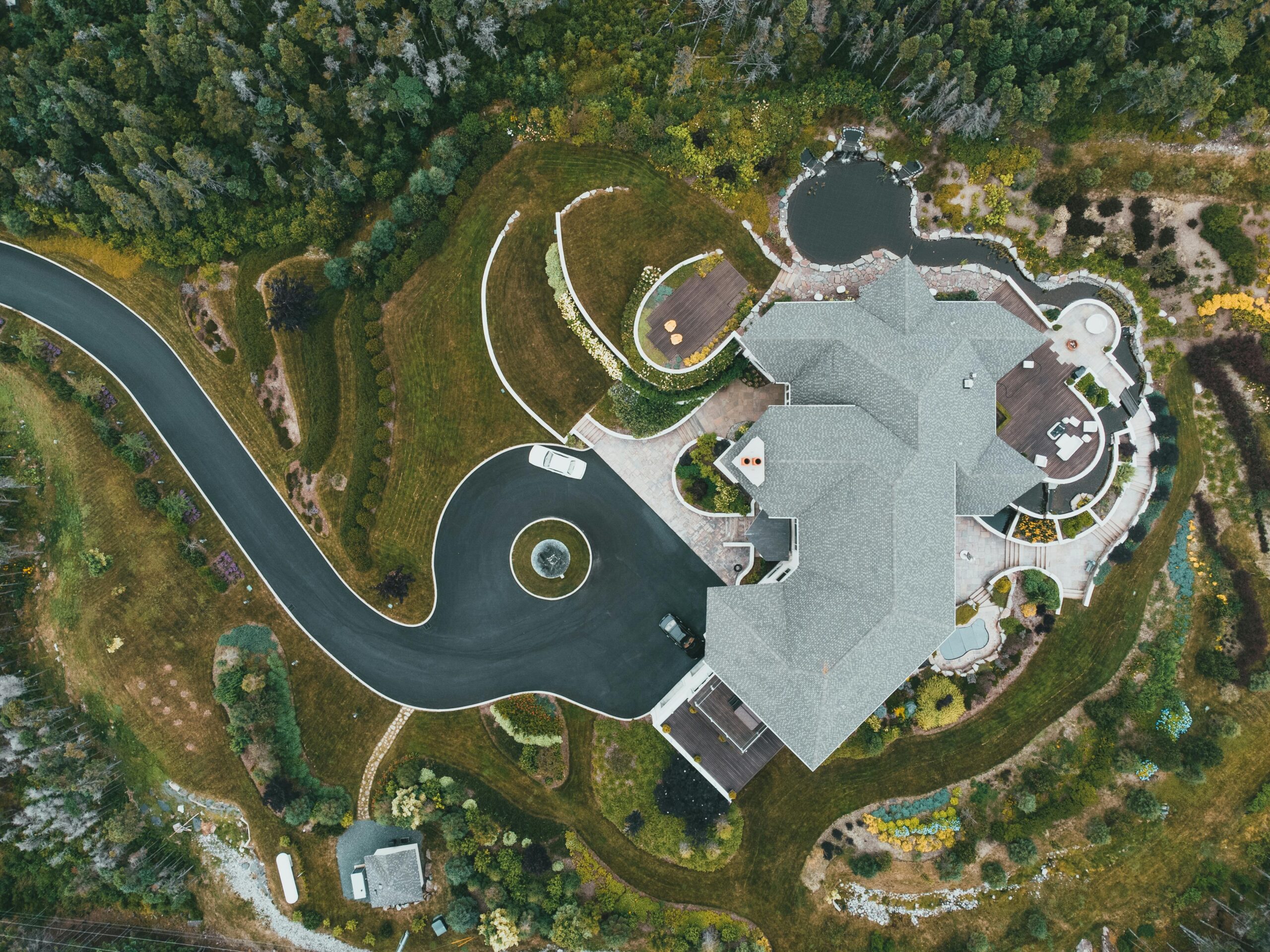
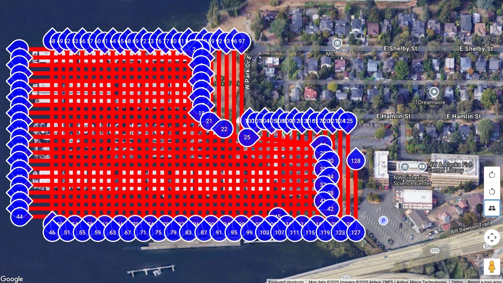
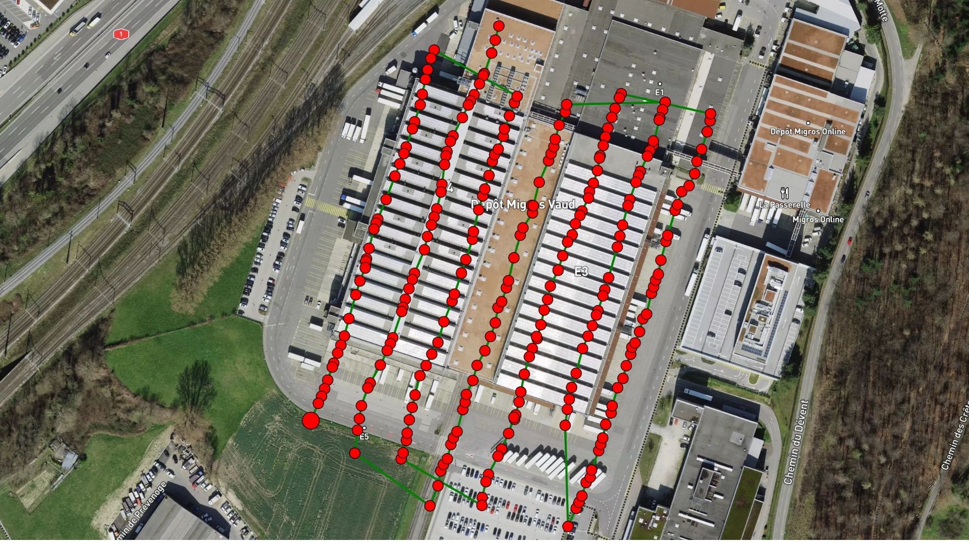
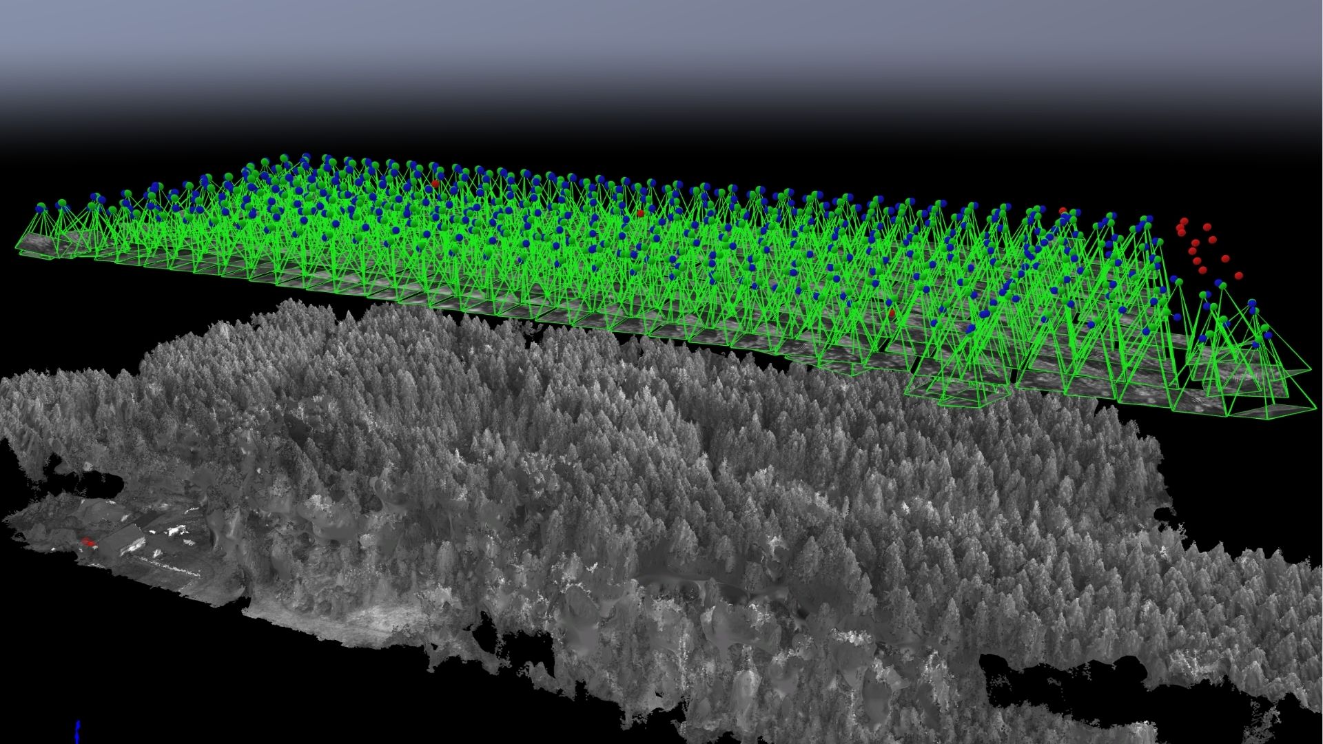
3D MAPS & MODELS
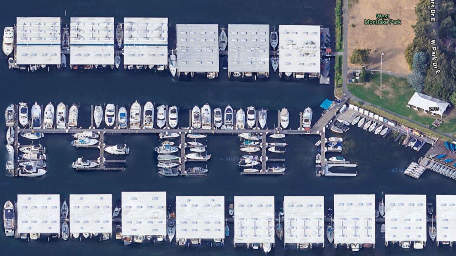
Create accurate 3D models, orthophotos, and elevation maps. Drone mapping supports better planning, tracking, and decision-making across construction, agriculture, mining, and inspection with clear visuals and precise data.
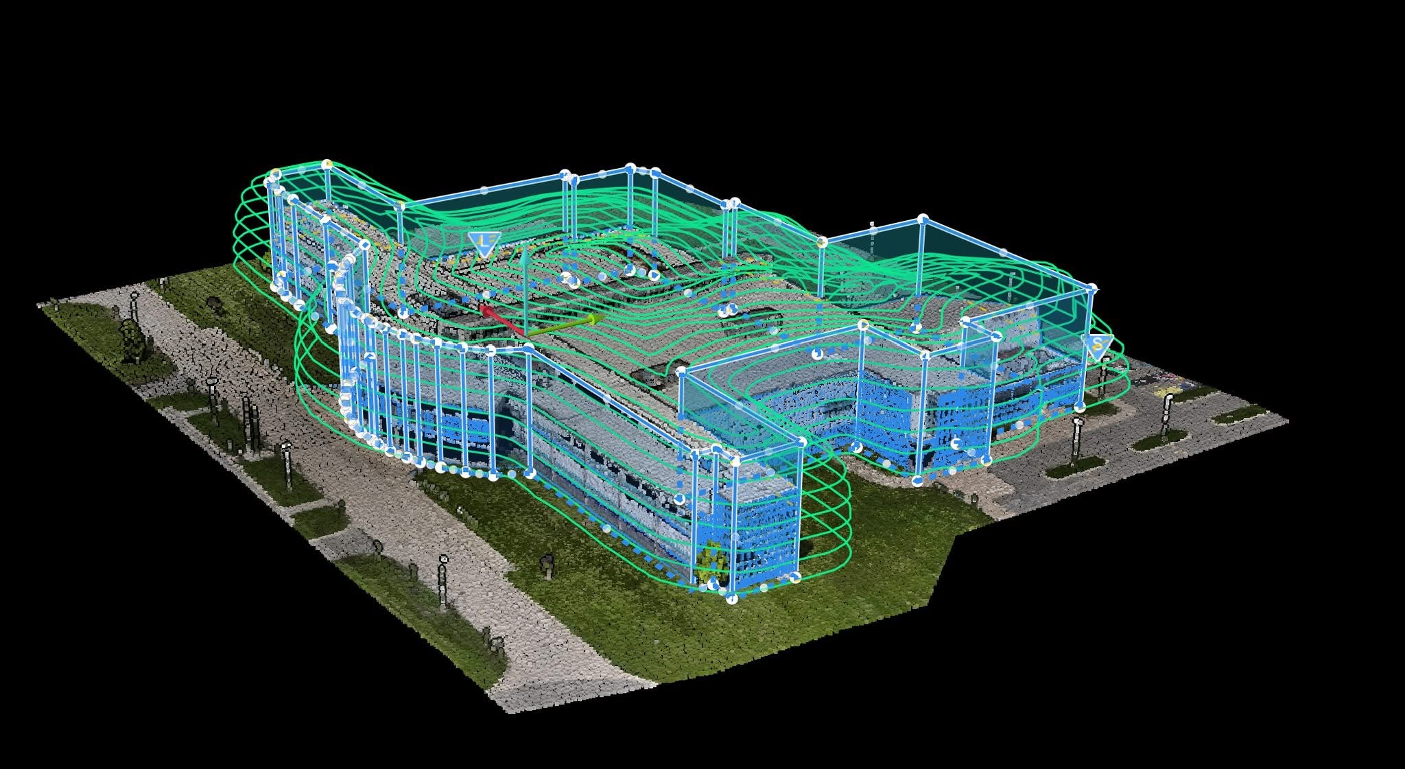
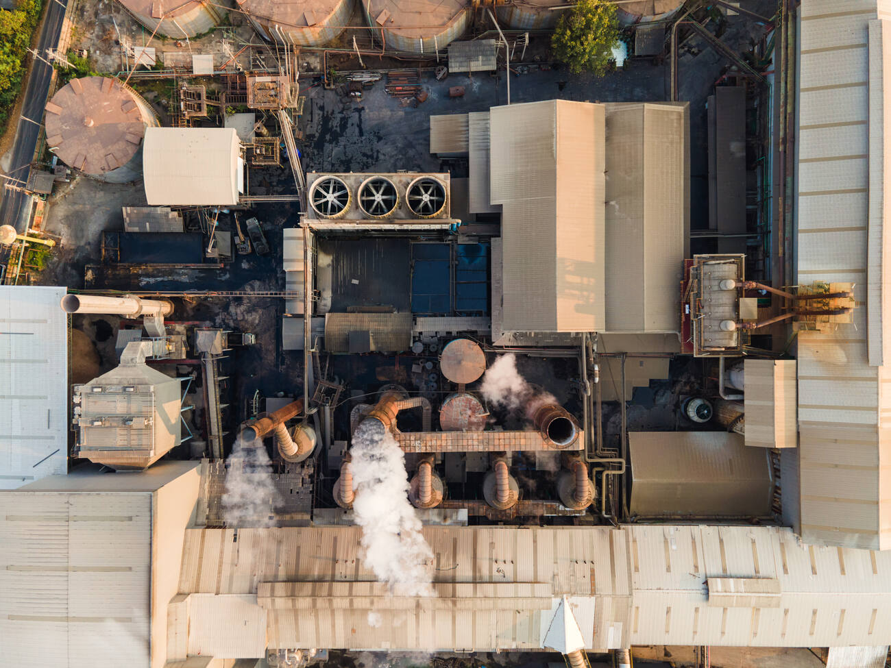
BUILDING
SURVEY
Drone photography offers a fast, cost-effective alternative to scaffolding, boom lifts, or elevated platforms. It improves safety, reduces downtime, and eliminates the need for working-at-height compliance procedures.
WHAT INDUSTRY
EXPERTS SAY
“Aerial mapping of construction sites makes it easier to catch errors early, before they become costly or hard to fix.” say leading experts, Engineering.com.
OUR WORK IN PROGRESS
At SkyTrak, we use drone technology to give you faster, more detailed mapping and surveying results. Our aerial data helps you work smarter, reduce field time, and make confident decisions backed by accurate visuals.
GET A QUOTE
Talk to us about your job requirements and let us create a custom drone based solution for your company.
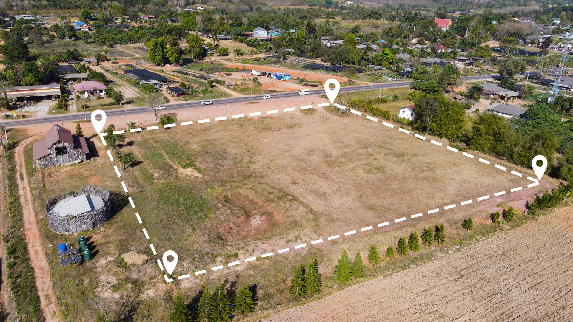
While SkyTrak Media is equipped to collect high-quality aerial data, please note that we do not interpret survey-grade information. For projects requiring precise measurements, a licensed land surveyor or survey engineer is still required. SkyTrak Media can collaborate with your licensed surveyor by providing aerial data; however, our services do not replace the role or legal authority of a licensed surveyor in any U.S. state. Additionally, we do not overlay property boundaries on residential or commercial lots — developed or undeveloped — for sale or marketing purposes. This is due to the same legal and professional limitations outlined above. This policy is not unique to our company — no drone service provider can legally interpret or certify survey data without a licensed surveyor on staff.
SECURE FORM
HOW CAN WE HELP?
Please provide details about your inquiry
By submitting, you agree to our
Privacy Policy
. and to assist SkyTrak drone services to better serve your needs.
