MY TOOLS
>
MISSION WORKFLOW
Aerial Survey, Inspection & Media Solutions
SkyTrak provides simple, convenient and custom drone service solutions for your industry
MISSION WORKFLOW
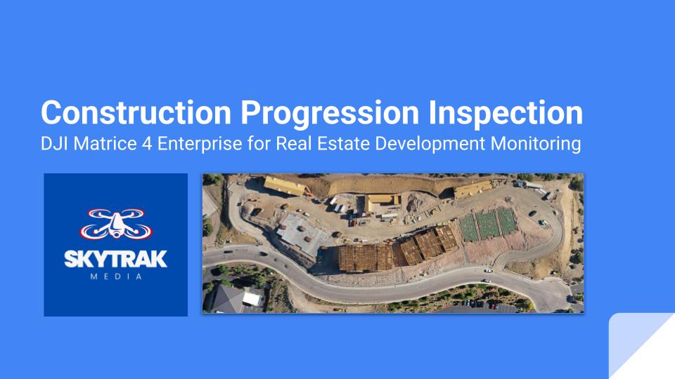
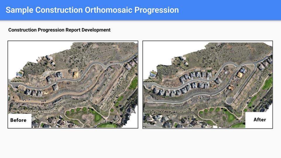
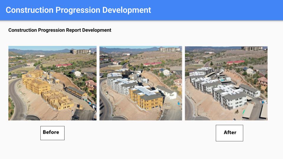
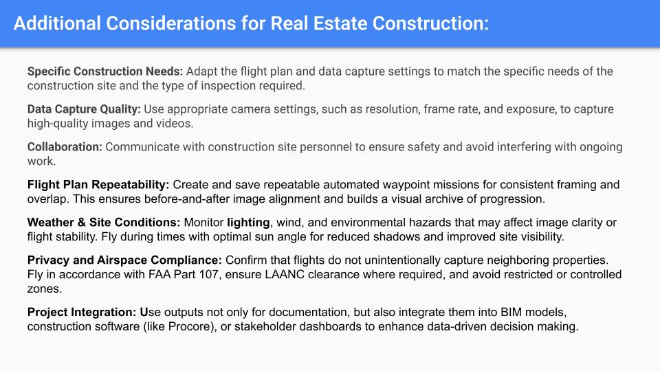
Mission Type: Aerial inspections for monitoring construction progression in residential and commercial real estate projects.
Mission Frequency: Scheduled weekly, bi-monthly, or monthly flights, tailored to project size and phase.
Output Deliverables:
- High-resolution 2D orthomosaic maps.
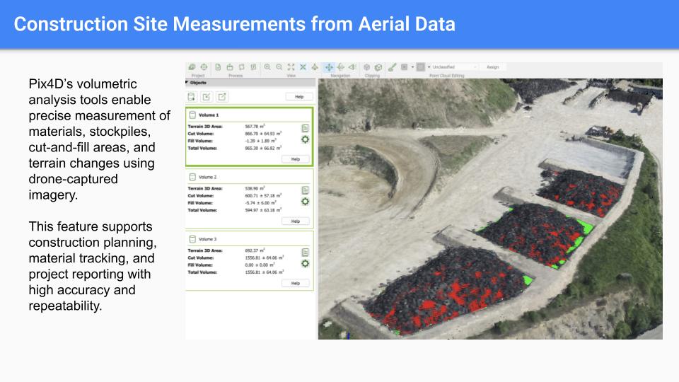
- 3D digital surface models for volumetric analysis.
- Time-lapse visualizations showcasing construction progress over time.
- Annotated aerial photographs and video walkthroughs for stakeholder presentations.
Click to enlarge and browse gallery
GET A QUOTE
Talk to us about your job requirements and let us create a custom drone based solution for your company.
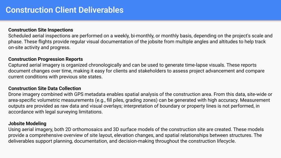
SkyTrak Media – Drone Data Disclaimer
While SkyTrak Media is equipped to collect high-quality aerial data, please note that we do not interpret survey-grade information. For projects requiring precise measurements, a licensed land surveyor or survey engineer is still required. SkyTrak Media can collaborate with your licensed surveyor by providing aerial data; however, our services do not replace the role or legal authority of a licensed surveyor in any U.S. state. Additionally, we do not overlay property boundaries on residential or commercial lots — developed or undeveloped — for sale or marketing purposes. This is due to the same legal and professional limitations outlined above. This policy is not unique to our company — no drone service provider can legally interpret or certify survey data without a licensed surveyor on staff.