Drones offer the flexibility to capture high-resolution data on demand, providing imagery at time intervals tailored to your project needs. From detailed site mapping to aerial visuals for stakeholder updates and verification photos for contract management, drone technology enhances oversight, communication, and progress tracking.
WHY USE DRONE FOR
CONSTRUCTION
INDUSTRY?
Drones are redefining how construction projects take shape. From build planning to progress tracking, they offer rapid, high-resolution views of your site, cutting costs, saving time, and giving developers the edge with more dynamic project insights.
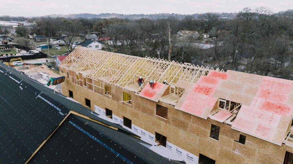
MONITOR
PROGRESS
Drones offer a powerful way to monitor construction progress with precision and clarity. High-resolution visuals can be easily shared across remote teams, investors, and stakeholders—keeping everyone informed, aligned, and engaged, no matter where they are.
SITE LOGISTICS
Contractors and project teams can’t be everywhere at once, but drones make it easier to stay connected. With aerial updates, you can monitor multiple job sites remotely, reduce travel, and get real-time insights beyond what reports alone provide.
WHAT INDUSTRY
EXPERTS SAY
Construction industry is the fastest growing commercial adapter of drone technology.“ — Drone Deploy —
OUR WORK IN PROGRESS
A drone offers a new vantage point for tracking progress, managing logistics, and staying ahead of project timelines. Embracing aerial data helps contractors build smarter, safer, and more efficiently with clear visual insight.
GET A QUOTE
Talk to us about your job requirements and let us create a custom drone based solution for your company.
While SkyTrak Media is equipped to collect high-quality aerial data, please note that we do not interpret survey-grade information. For projects requiring precise measurements, a licensed land surveyor or survey engineer is still required. SkyTrak Media can collaborate with your licensed surveyor by providing aerial data; however, our services do not replace the role or legal authority of a licensed surveyor in any U.S. state. Additionally, we do not overlay property boundaries on residential or commercial lots — developed or undeveloped — for sale or marketing purposes. This is due to the same legal and professional limitations outlined above. This policy is not unique to our company — no drone service provider can legally interpret or certify survey data without a licensed surveyor on staff.
SECURE FORM
HOW CAN WE HELP?
Please provide details about your inquiry
By submitting, you agree to our
Privacy Policy
. and to assist SkyTrak drone services to better serve your needs.


