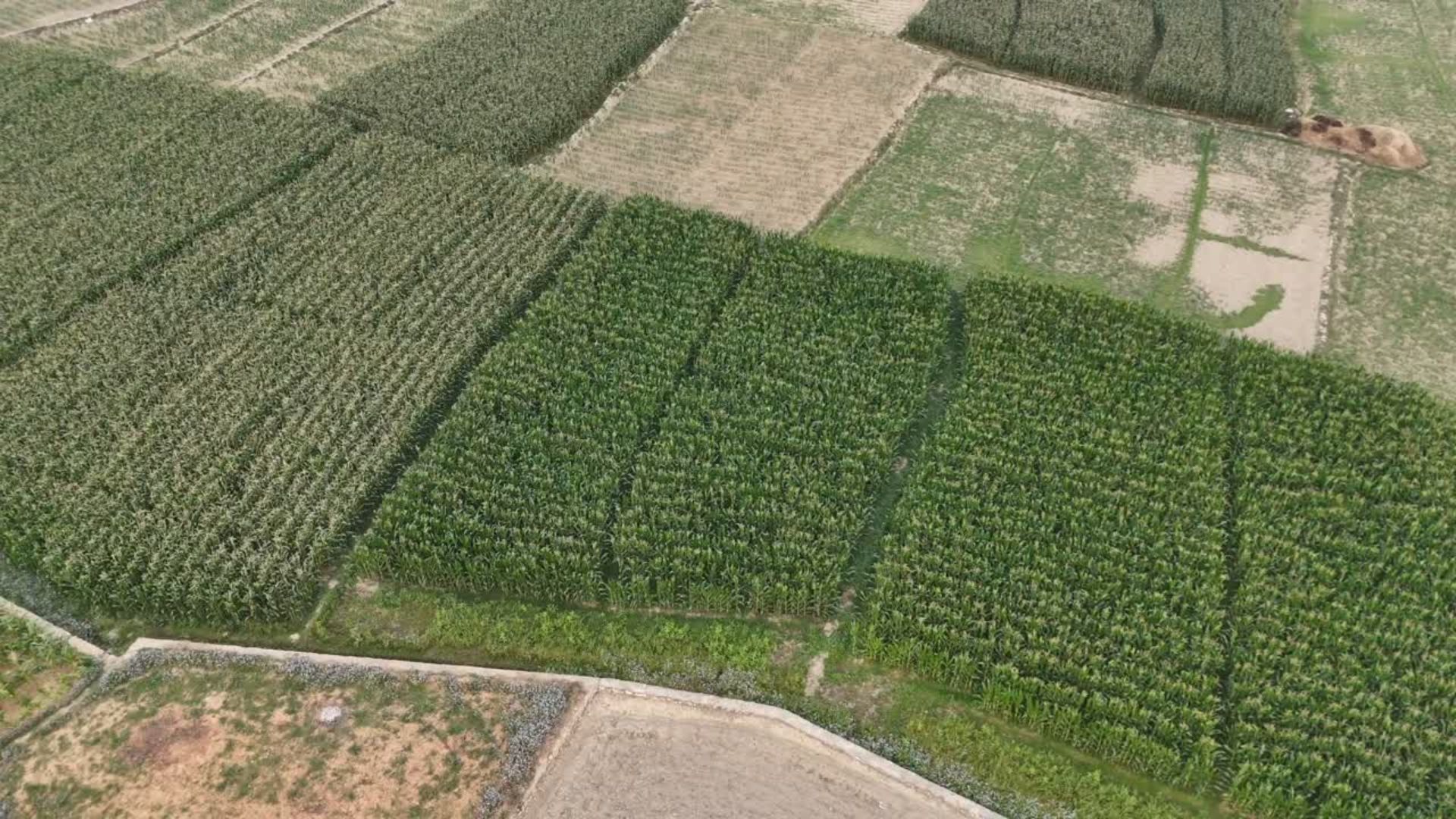
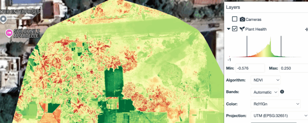
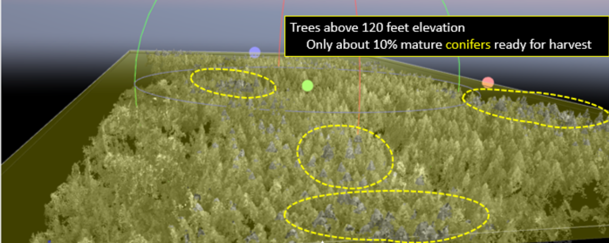
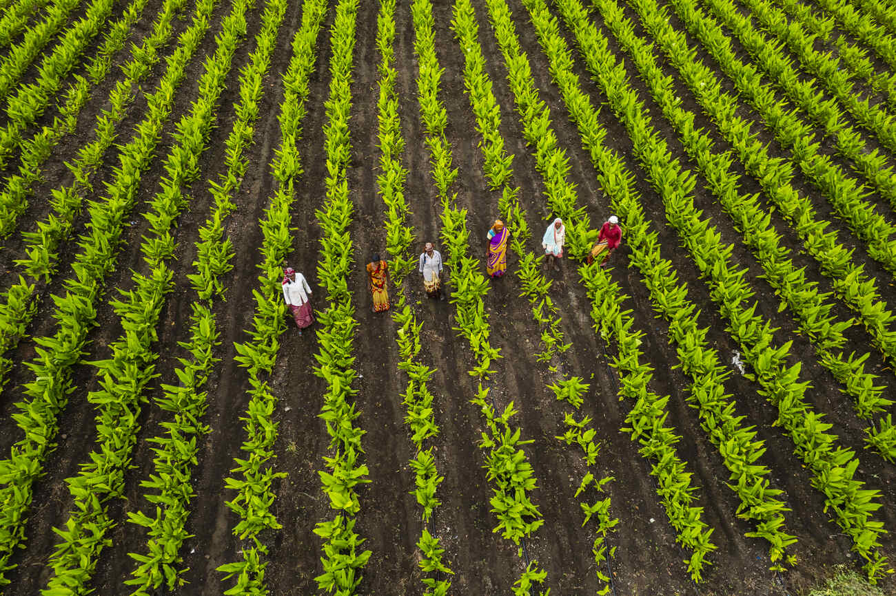
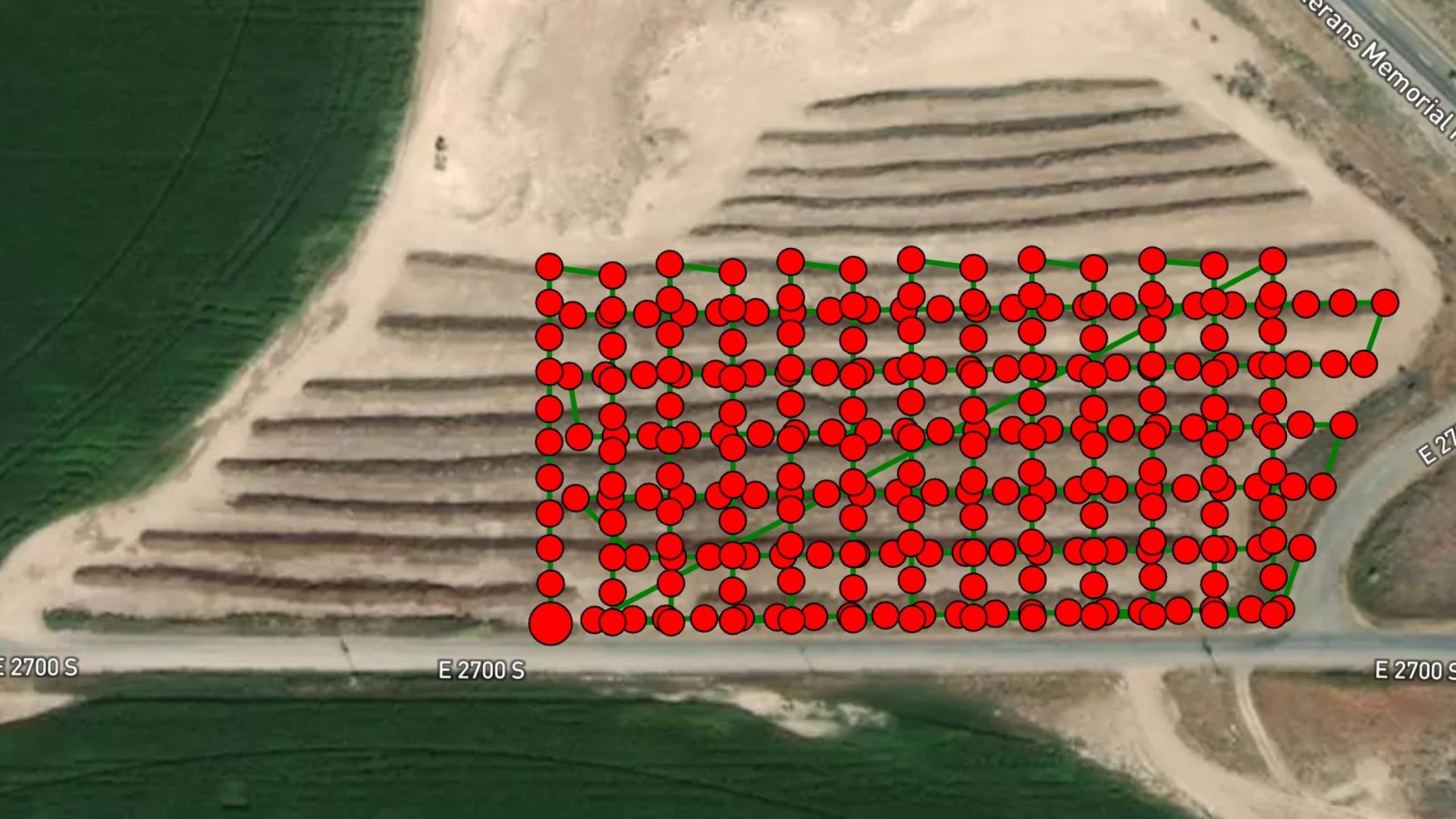
Drones can be customised for a wide range of industries, from agriculture to surveillance. In farming, they help identify failing crops early, manage irrigation systems, and take inventory of land and resources. Drones are also used to count livestock, locate missing animals, and support search and rescue operations in rural or hard-to-reach areas.
WHY USE
DRONE?
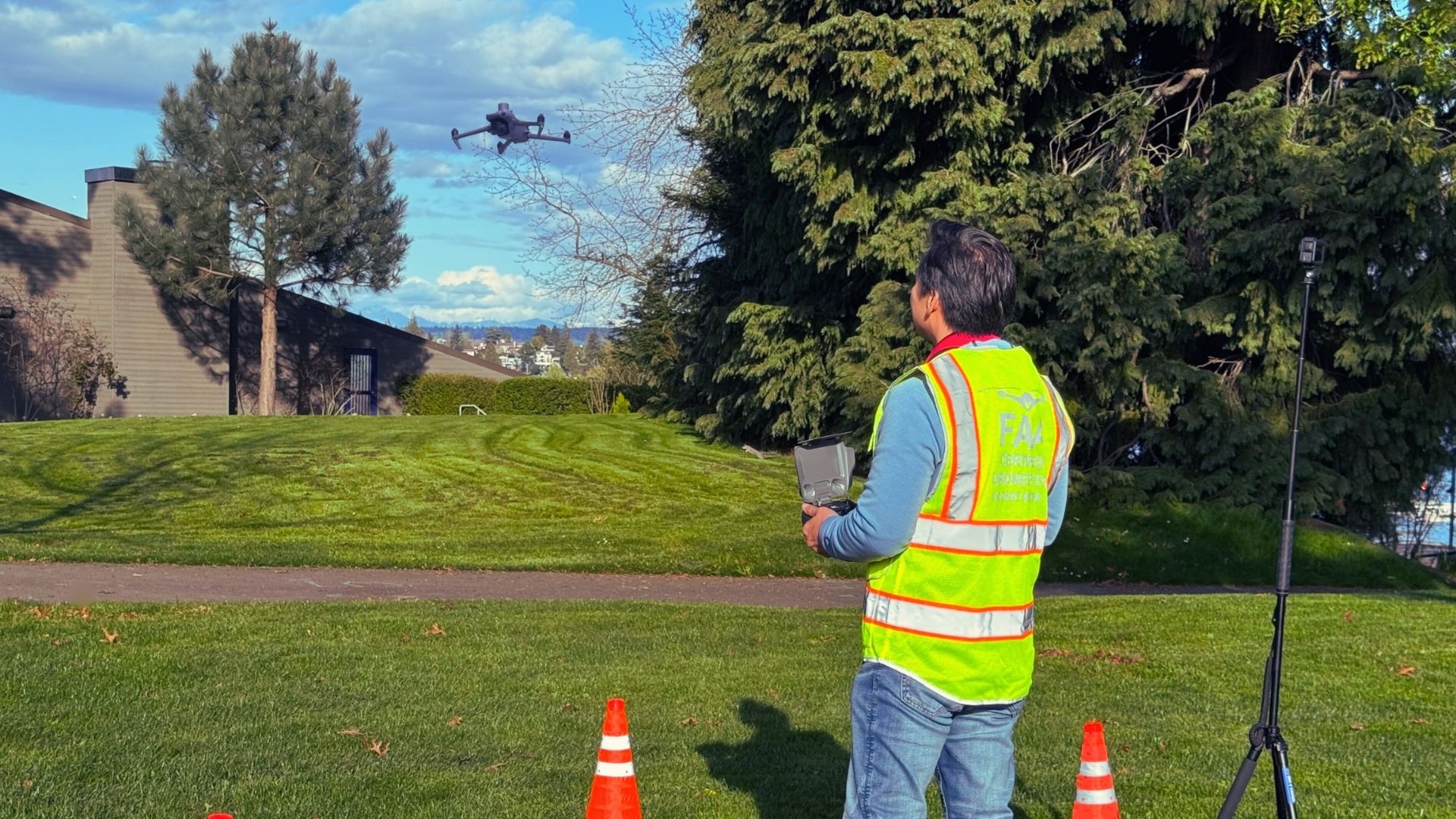
Industries are adapting quickly to new technologies, and drones are at the forefront of this transformation. Drones are especially valuable for tasks that are repetitive, hazardous, or hard to access. Their ability to gather data quickly and safely makes them a highly cost-effective solution across many sectors.
CUSTOM DRONE
SOLUTIONS
Looking for something specific?
SkyTrak Media offers tailored drone solutions built around your unique needs. Whether it’s a special project or a new application, we’ll help you make it happen.
CLIENT FOCUSED SOLUTIONS
SkyTrak Media collaborates with clients on both one-time projects and long-term contract engagements. Whether your needs are immediate or ongoing, we deliver tailored drone solutions designed to meet your goals with consistency and precision.
WHAT INDUSTRY
EXPERTS SAY
“Construction industry is the fastest growing commercial adapter of drone technology.” — Drone Deploy —
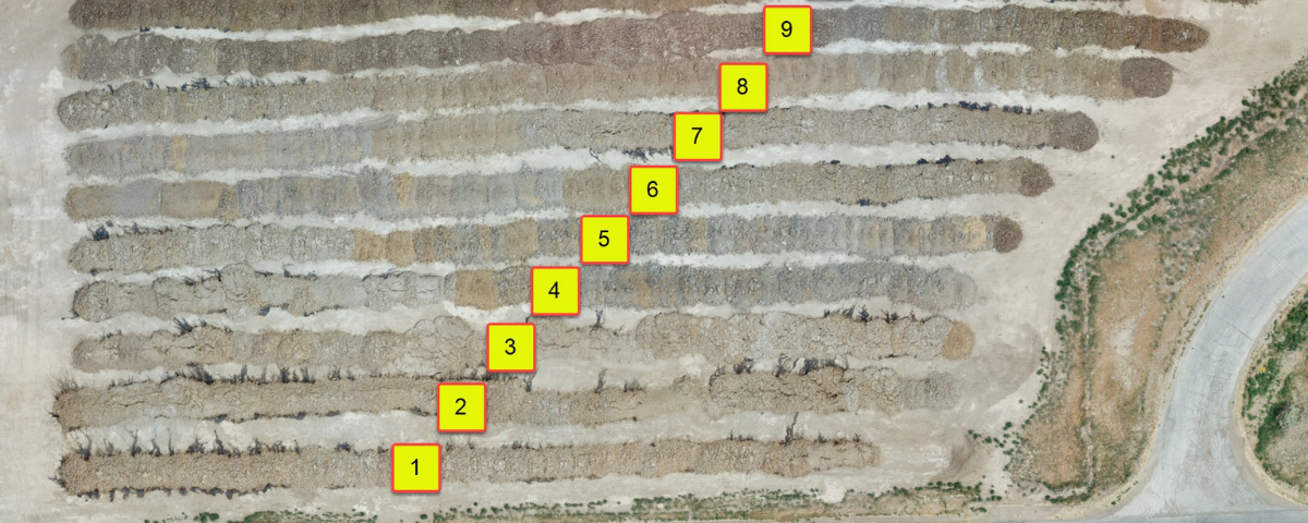
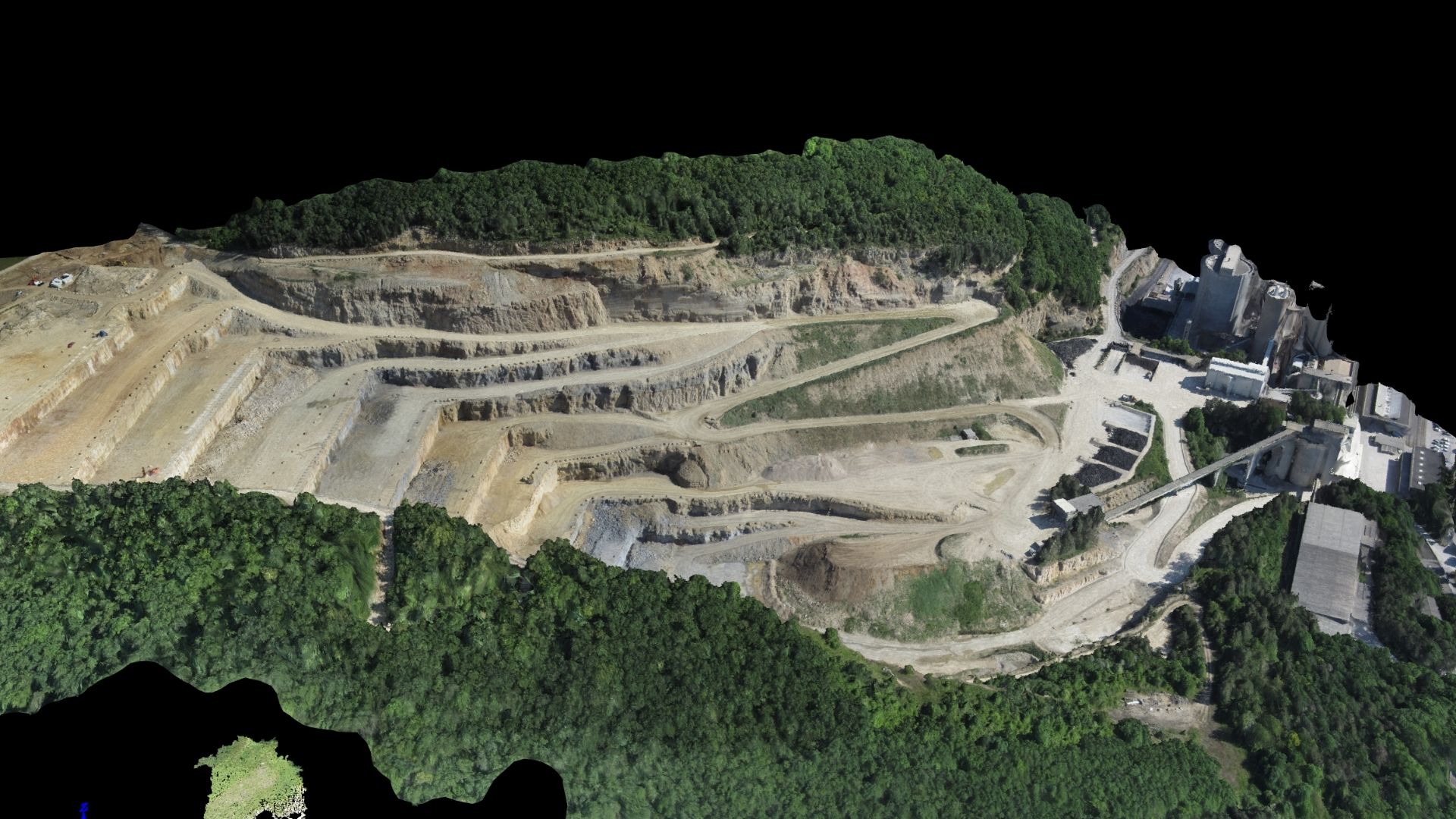
OUR WORK IN PROGRESS
A drone can be adapted to meet your specific industry needs, from agriculture to emergency response. Custom drone solutions open up new opportunities for data, efficiency, and results that drive real-world impact.
GET A QUOTE
Talk to us about your job requirements and let us create a custom drone based solution for your company.
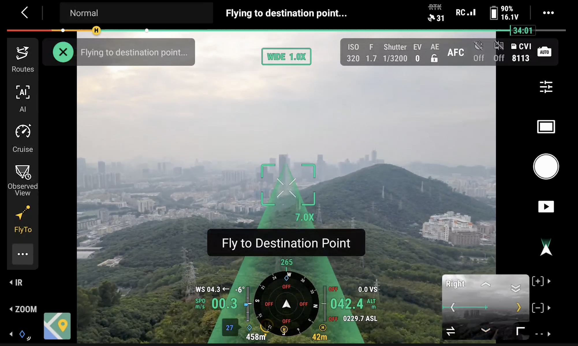
While SkyTrak Media is equipped to collect high-quality aerial data, please note that we do not interpret survey-grade information. For projects requiring precise measurements, a licensed land surveyor or survey engineer is still required. SkyTrak Media can collaborate with your licensed surveyor by providing aerial data; however, our services do not replace the role or legal authority of a licensed surveyor in any U.S. state. Additionally, we do not overlay property boundaries on residential or commercial lots — developed or undeveloped — for sale or marketing purposes. This is due to the same legal and professional limitations outlined above. This policy is not unique to our company — no drone service provider can legally interpret or certify survey data without a licensed surveyor on staff.
SECURE FORM
HOW CAN WE HELP?
Please provide details about your inquiry
By submitting, you agree to our
Privacy Policy
. and to assist SkyTrak drone services to better serve your needs.


