MY TOOLS
>
Client Deliverables
Aerial Survey, Inspection & Media Solutions
SkyTrak provides simple, convenient and custom drone service solutions for your industry
AERIAL DATA OUTPUTS
SkyTrak Media offers a wide range of aerial data deliverables tailored to meet both the technical and visual needs of your business. Some outputs are ideal for marketing and client presentations, while others support analysis, planning, and internal operations. Whatever your goals, we’ll guide you in selecting the right formats to bring your vision to life.
The final outputs depend on how you plan to use the data. Some assets—such as job site documentation—may be for internal use only, while others can be shared with clients or embedded directly into your website for broader visibility. Below is a list of common formats SkyTrak Media can deliver:
- GeoTIFFs – High-resolution 2D orthomosaics
- Full-size JPEGs – 2D high-quality images
- DEM (Digital Elevation Models) – 2D elevation mapping
- NDVI – Vegetation health and analysis imagery
- KMZ for Google Earth – 3D visualization
- Point Cloud (LAS) – 3D spatial data
- OBJ – 3D textured mesh models
- O3D Formats – Including PLY, FBX, and DXF
The right mix of formats will depend on your project goals and how the data will be used. We’re happy to walk you through the options and build a delivery plan that fits your needs. Let’s talk about how SkyTrak Media can support your next project, contact us today to get started.
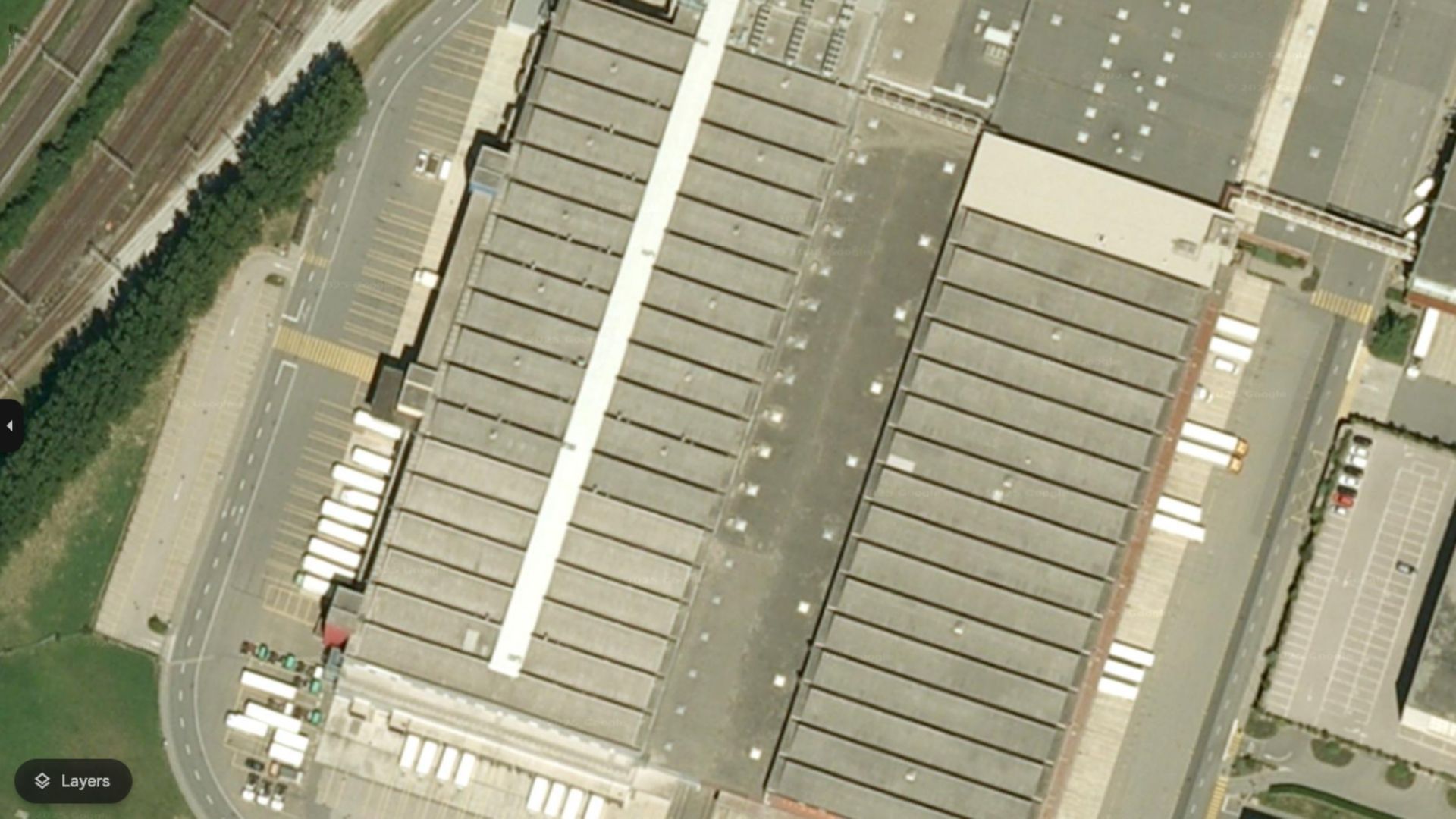
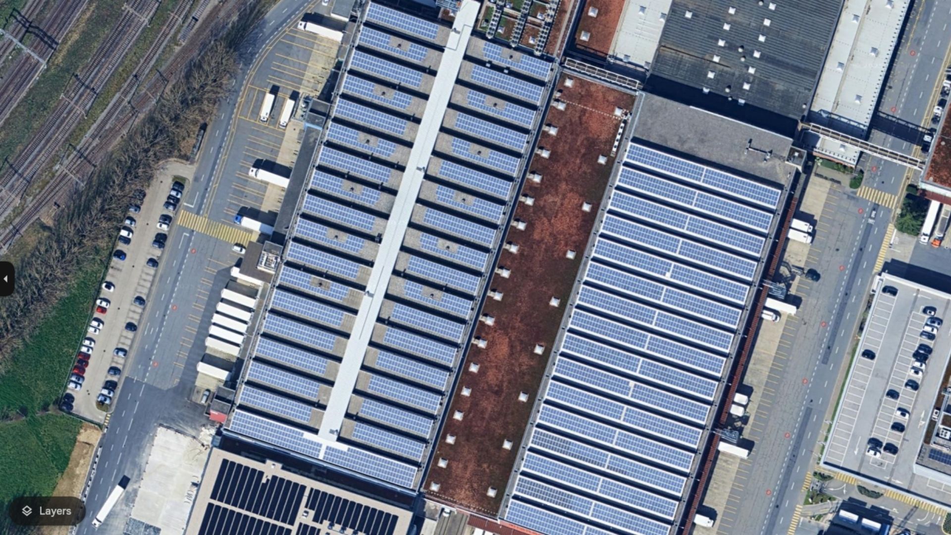
Building Roof Solar Inspection
You’ll receive annotated thermal images, detailed inspection reports, and high-resolution photos highlighting panel conditions, potential hotspots, and damage indicators—perfect for insurance or maintenance teams.
Business use case: Ideal for solar asset managers, property owners, and insurance adjusters who need fast, accurate documentation to ensure energy performance, warranty compliance, and risk mitigation.
3D Job Site Model
Delivered as an interactive 3D model (viewable online) along with downloadable orthomosaics, digital surface models (DSM), and point cloud files compatible with CAD and GIS platforms.
Business use case: Used by construction managers, engineers, and site planners for as-built documentation, volume calculations, design validation, and stakeholder progress reviews without needing to visit the site.
360 Degree Virtual Tour
Immersive, clickable tours with panoramic views, custom info tags, and web-embedded links—ideal for showcasing interiors, real estate, or facility layouts remotely.
Business use case: Perfect for real estate agents, developers, or commercial brokers who want to offer remote walkthroughs to prospective buyers, tenants, or investors from any location.
Before and After Mapping
You’ll receive geo-referenced orthomosaic maps and side-by-side comparison visuals, great for tracking site progress, environmental changes, or construction milestones.
Business use case: Beneficial for project managers, government contractors, or land developers tracking visual changes, grading activity, erosion control, or regulatory compliance over time. This deliverable is also valuable for banks, investors, and lenders seeking periodic visual updates for loan monitoring, construction draw schedules, and investment risk assessments.
Real Estate Portfolio
Clients will receive professionally edited aerial video flyovers, interior walkthroughs, and cinematic home tours tailored for listing websites and social media.
Business use case: Ideal for realtors, brokers, and property developers aiming to stand out in competitive markets. Aerial views provide perspectives not visible from eye level, such as backyard size, roof condition, neighborhood layout, and nearby amenities—helping buyers visualize the full property experience before visiting in person.
GET A QUOTE
Talk to us about your job requirements and let us create a custom drone based solution for your company.
SkyTrak Media – Drone Data Disclaimer
While SkyTrak Media is equipped to collect high-quality aerial data, please note that we do not interpret survey-grade information. For projects requiring precise measurements, a licensed land surveyor or survey engineer is still required. SkyTrak Media can collaborate with your licensed surveyor by providing aerial data; however, our services do not replace the role or legal authority of a licensed surveyor in any U.S. state. Additionally, we do not overlay property boundaries on residential or commercial lots — developed or undeveloped — for sale or marketing purposes. This is due to the same legal and professional limitations outlined above. This policy is not unique to our company — no drone service provider can legally interpret or certify survey data without a licensed surveyor on staff.